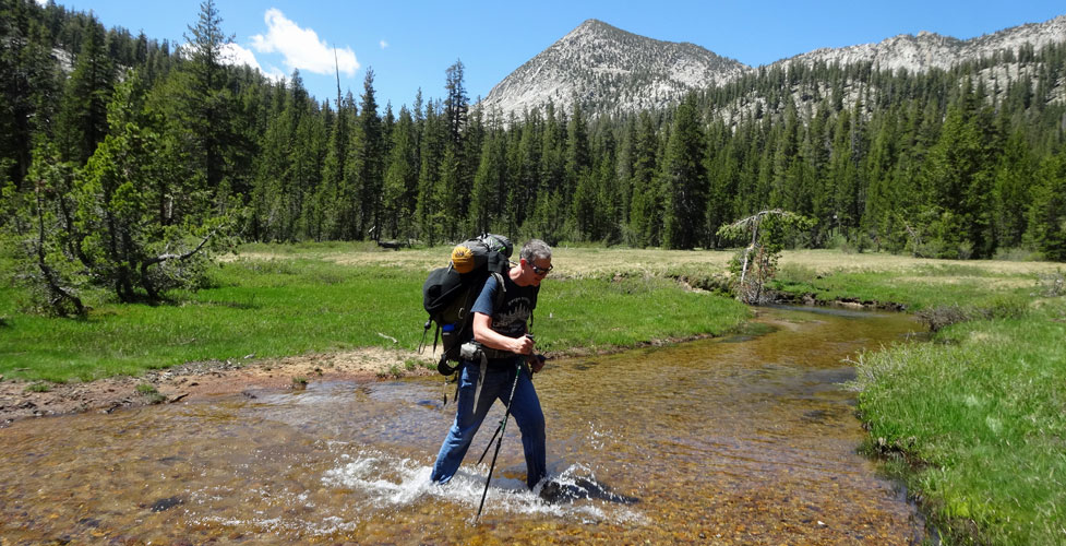
Ebbetts Pass Backpacking Trails
Ebbetts Pass Backpacking trails lead to inviting destinations on either side of the pass, from quiet alpine lakes only a few miles from the road to adventurous hikes that wind along canyon rims and dip into secluded valleys.
The famous Pacific Crest Trail runs along the spine of the Sierra, crossing Highway 4 at Ebbetts Pass. Hikers can set out on the PCT in either direction and within a couple of days hiking be at the next highway pass, Carson Pass to the north or Sonora Pass to the south.
The Carson-Iceberg Wilderness spreads to the south of Ebbetts Pass, with miles of trail protected from the intrusion of vehicles. Camp along the wild upper reaches of the East Carson River or explore the wild country around the Dardanelles. Many of the trips listed below enter the Carson-Iceberg Wilderness and require wilderness permits for overnight camping. Pick up a permit in Hathaway Pines or Carson City.
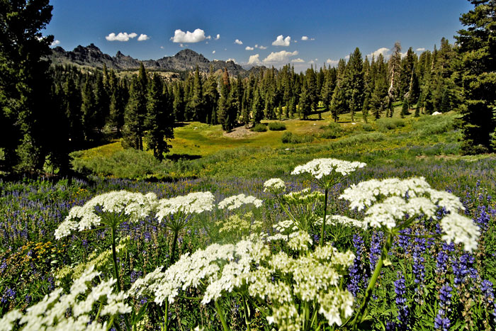
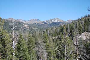
View from Pacific Crest Trail at Ebbetts Pass
1. Horse Meadow
Trailhead: Spicer Meadows Reservoir
Distance: 6 miles one way - 2 Days
Elevation: 6,400' - 7,100'
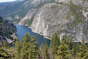
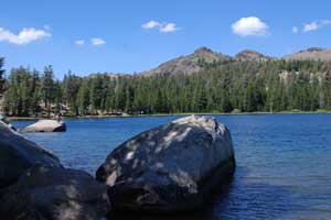
The Horse Meadow trip offers spectacular views of the Dardanelles and the Middle Fork of the Stanislaus River Canyon by Donnell Reservoir (shown right). Since it is in the Carson-Iceberg Wilderness, you will need a wilderness permit to camp. From the trailhead at the dam at Spicer Reservoir, follow the trail south up over the saddle by Whittakers Dardanelle. Then drop into Wheats Meadow and continue south to Horse Meadow. The camping spot is close to several high points which overlook the spectacular Stanislaus River Canyon and Donnell Reservoir.
2. Ebbetts Pass to Sonora Pass
Trailhead: Ebbetts Pass
Distance: 26 miles - 3 Days
Elevation: 8,100' - 10,500'
Set this up as a shuttle, leaving a car at Sonora Pass or Ebbetts Pass, whichever is the end of your trip, and drive a second car to your starting point. Actually, beginning at Sonora Pass is easier because the trailhead there is almost a thousand feet higher than Ebbetts Pass. Nevertheless, our trail description begins at Ebbetts Pass at the Pacific Crest Trail parking lot.
Set out south, crossing the ridge near Tryon Peak and descending to Wolf Creek for your first campsite at mile 7. The second day climb up past Disaster Peak, circling the head of Golden Canyon, and then dropping into the East Carson River canyon for your second night, an 11 mile day. Your final day climbs steadily 2500 feet to the shoulder of Sonora Peak and then descends to Sonora Pass, 8 miles.
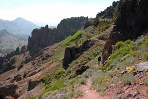
3. Ebbetts Pass to Carson Pass
Trailhead: Ebbetts Pass
Distance: 24 miles - 3 Days
Elevation: 8,800' - 7,800' - 9,000' - 8,600'
The Pacific Crest Trail from Ebbetts Pass to Carson Pass is easier than the section going south to Sonora Pass. There are numerous ups and downs on the way to Carson, but the biggest climb is only 1,200 feet.
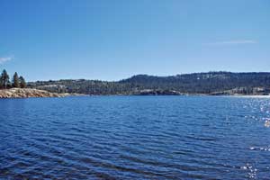
Park at the trailhead parking lot and take the little side trail up to meet the PCT and turn right, soon crossing Highway 4. Continue north past Upper Kinney Lake (shown left) and along the rugged shoulders of Reynolds and Raymond peaks. You could camp as early as Pennsylvania Creek, but if you're feeling strong push all the way through to Wet Meadows Reservoir, 11 miles. The next day cross the Blue Lakes area where you'll see people and cars and keep on going up to Lost Lakes for your second night, a 7-mile day with a big climb. The last leg of the trip meanders down to Forestdale Creek and then up to Carson Pass, 6 miles.
4. Carson Falls Loop
Trailhead: Wolf Creek
Distance: 23 miles - 3 Days
Elevation: 6,500' - 8,000' - 6,600' - 8,800' - 6,500'
This scenic loop takes you along the High Trail out of Wolf Creek, crossing a ridge and then descending into the East Fork of the Carson River Valley. Camp at mile 8 near where the trail crosses the river in Dumonts Meadows. The next day head upstream. At Falls Meadow take a mile hike up to Carson Falls and then return to the meadow and follow the trail switch-backing up Murray Canyon. Avoid side trails heading south. Descend to Wolf Creek before looking for a campsite, 8 miles. On your final day follow Wolf Creek down to your trailhead, 7 miles.
5. Spicer Meadow Reservoir Loop
Trailhead: Summit Lake
Distance: 17 miles - 2 days
Elevation: 7,000' - 6,400' - 7,100' - 6,400'
This loop around Spicer Meadow Reservoir is best done by leaving one car at the trailhead by the dam and driving the other out to the Summit Lake Trailhead.
The trail crosses Wilderness Creek and then drops to the shore of the upper end of Spicer Meadow Reservoir where no motorized boats are allowed. The route circles the upper end of the lake, crossing Highland Creek, a good camping spot (6 miles). More ambitious hikers could continue to Sword and Lost lakes to camp at mile 9. From there the trail leaves Spicer and drops into Dardanelle Creek before crossing a low ridge to Wheats Meadow (mile 13). From there a 500' climb over another ridge opens the way back to the end of the hike at the Spicer Meadow Reservoir dam trailhead.
Experienced cross-country hikers could lay out a route from Sword and Lost lakes much closer to Spicer, skipping the diversion to Dardanelle Creek and Wheats Meadow (shortening the loop by 3 miles).
6. Bull Run and Heiser Lakes
Trailhead: Stanislaus Meadow
Distance: 9 miles round trip - 2 Days
Elevation: 7,400' - 8,400' - 7,900' - 8,400'
This easy hike takes you to two beautiful mountain lakes where you can camp, swim, and fish. It is short enough that it is a good trip on which to take children.
Start at the Stanislaus Meadow Trailhead, 4.5 miles east of Lake Alpine. Descend a slight grade to the Stanislaus River and then climb to Bull Run Lake, 3 miles. After lunch at the lake, return one mile to the Heiser Lake trail and follow it to the lake, about 5.5 miles from the trailhead. Camp there in the shadow of Bull Run Peak. A short hike from the lake takes you to the rim of Pacific Valley. The next day return the 4 miles to the trailhead.
7. Silver King Loop
Trailhead: Wolf Creek
Distance: 24 miles - 3 days
Elevation: 6,400' - 7,800' - 6,400'
This loop route up the East Fork of the Carson River and Silver King Creek is best done in late season when water levels are low because the trail makes a number of river crossings. Some of the area is closed to fishing, so check California's regulations before you set out. Enjoy a leisurely walk up the Carson River past Vaquero Camp and then up Silver King Creek. Camp at the junction of Snodgrass Creek, 8 miles. The next morning climb a thousand feet up Silver Creek Trail, passing through Poison Flat before descending into Dumonts Meadow to camp, 7 miles. The next day follow the East Carson River downstream back to your trailhead.
Backpacking on Sonora Pass and Carson Pass
Sonora Pass
Sonora Pass (Highway 108), just a few miles to the south, is famous for its backpacking in the Emigrant Wilderness and the Hoover Wilderness. For backpacking ideas on Sonora Pass, take a look at our sister website, Sonora Pass Vacations.
Carson Pass
To the north is Carson Pass with backpacking opportunities in the Mokelumne Wilderness. For a list of suggested backpacking trips on Carson Pass, visit another of our sister websites, Up and Over Carson Pass.