Day Hikes around Ebbetts Pass
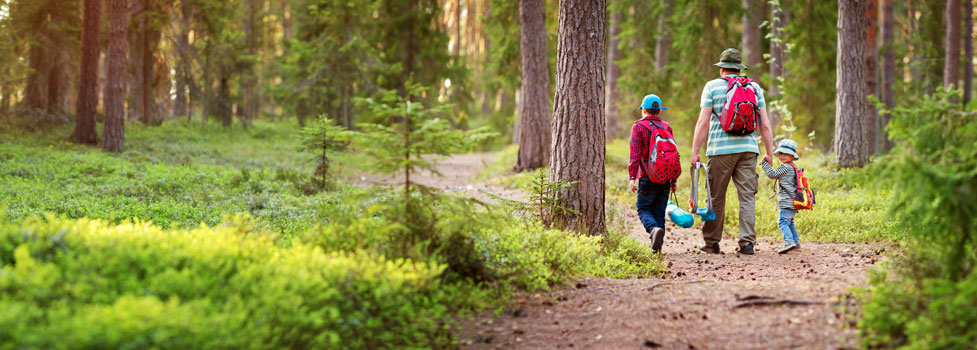
Day Hikes can range from leisurely quarter mile strolls to full day outings to strenuous mountain summits. Among the best places for day hikes on well-marked trails are Calaveras Big Trees State Park, Lake Alpine, and Grover Hot Springs State Park.
Another great day hiking destination is the Arnold Rim Trail which extends from White Pines Lake west to Avery Sheep Ranch Road. Another popular hiking outing is to follow the Pacific Crest Trail either north or south from the top of Ebbetts Pass. We have them all here - the best day hikes on both sides of Ebbetts Pass.
Calaveras Big Trees State Park
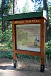
Arnold Rim Trail
Distance: 10.5 miles one way, hiking trail
Elevation Changes: approx. several hundred feet
The Arnold Rim Trail currently runs from White Pines Lake west to Sheep Ranch Road near Avery. This 11.2-mile section of trail is only the first of what is proposed to be a 35-mile trail connecting with Calaveras Big Trees State Park. A 6-mile section of trail continuing across Sheep Ranch Road and down near the Calaveras Ranger District office in Hathaway Pines is currently under construction. The trail is open to hikers, mountain bikers, and equestrians.
A new, short, paved section at leading out from the Logging Museum at White Pines Lake is closed to horses, but a 2-mile alternate equestrian route circumvents the asphalt portion.
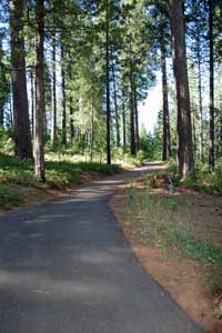
The trail makes a great day hike for anyone visiting White Pines Lake near Arnold. You can hike out the trail as far as you like, whether a quarter mile or ten, and then head back.
The Arnold Rim Trail generally follows San Antonio Creek, crossing from its north side to the south about 2.5 south of White Pines Lake. Along its course the trail passes locations such as Penny Pines, Cougar Rock, and the San Antonio Falls overlook.
The trail was created as a collaboration among volunteers in the Arnold Rim Trail Association, other community volunteers, Calaveras County, and Forest Service agencies. The trail was build with volunteer labor. The route is marked with signs and also has several interpretive kiosks.
Maps of the trail can be picked up at the Forest Service office in Hathaway Pines.
For more information about the trail, visit Arnold Rim Trail
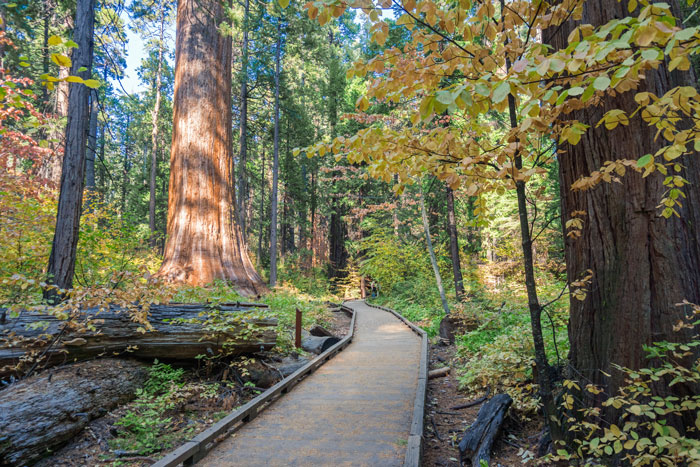
Calaveras Big Trees State Park
North Grove
Distance: 1.5 miles loop, smooth walking surface
Elevation Changes: Level
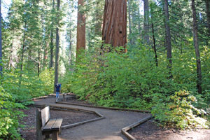
The North Grove is adjacent to the parking lot and has easy access. The 1.5-mile tour of the grove is along a level, easy to walk trail. Among the highlights of the grove are the Big Stump, the Pioneer Cabin Tree, the Father of the Forest, and the Empire State Tree. The Empire State Tree measures 18 feet in diameter near its base. Giant Sequoias can live to be over 3,000 years old.
South Grove
Distance: 3.5 or 5 miles loop, forest trail
Elevation Changes: 500 feet gain and loss
The South Grove is reached by driving 9 miles from the entrance gate down across the Stanislaus River and up to the parking area at the trailhead to the South Grove. The South Grove contains far more trees than the North Grove, but is less often visited because of its remoteness and more strenuous trail. The road to the South Grove is closed
in the winter.
Loop trails through the grove are either 3.5 or 5 miles. Both routes begin with a moderate uphill climb. Hikers are rewarded with views of the park's largest tree, the Agassiz Tree, along with the Smith Cabin Tree, Old Goliath, and the Moody Group.
Bradley Grove
Distance: 2.5 miles loop, forest trail
Elevation Changes: 200 feet gain and loss
The Bradley Grove trail begins to the left of the South Grove Trail just beyond the Beaver Creek Bridge. The 2.5-mile loop contains some "outrigger" giant sequoias along with many younger trees planted in the 1950s. The Bradley Grove also has stands of sugar pines, mountain dogwood and white alder.
For more information about the state park and a map of the park, see
Calaveras Big Trees State Park.
Sourgrass
Distance: 1.5 miles one way, old 4-wheel dirt road
Elevation Changes: 200 feet
Begin at the Day Use area at Sourgrass and hike up the side of the North Fork of the Stanislaus River. In the spring the rushing river is exciting to see from a safe distance. In late summer pools and riffles make great places for fishing. Find a secluded spot for a picnic along the river's edge.
For more information about the Sourgrass and a map of the area, see
Sourgrass Camping.
Spicer Meadow Reservoir Area
Elephant Rock Lake to Rock Lake
Distance: 1.8 miles one way, mountain trail
Elevation Changes: 800 feet gain going out
Drive out to the end of the Summit Lake Road off Spicer Meadow Reservoir Road. Hike from Elephant Rock Lake past Elephant Rock and up to Rock Lake. For an easier hike only go as far as Elephant Rock, a half mile each way over fairly level terrain.
Around Utica Reservoir
Distance: 6 miles one way, cross-country
Elevation Changes: 100 feet up and down
There is no established trail around Utica Reservoir, but a fairly obvious use trail circles the lake. Do all or part of the convoluted shore line. Bring your fishing rod and fresh water. Expect to take longer than you might walking on an established trail.
Spicer to Sand Flat
Distance: 5.5 miles one way, mountain trail
Elevation Changes: Drop 1000 feet going out
Start at Spicer Reservoir and hike through Corral Meadow and then make then steep descent into the Stanislaus River Canyon, arriving there at Sand Flat. There is a bridge, so you could cross and hike up to Highway 4 at Big Meadow for a pick-up (2.3 miles, 800-foot climb). Shorten this hike by beginning at Gardner Meadow on the Spicer Reservoir Road (2.5 miles to Sand Flat, 900-foot drop).
For more information about the Spicer Reservoir area and a map, see
Spicer Reservoir.
Bear Valley and Lake Alpine
Around Lake Alpine
Distance: 4-mile loop, mountain trail, dirt roads, paved trail
Elevation Changes: 100 feet up and down
The 4-mile hike around the lake is a great tour of the area. Traveling
in a clockwise direction makes for slightly easier trail finding. The trail begins from the road's end near Pine Marten Campground. Follow it down the southeast shore and then across the creek below the dam. From there you pick up dirt roads back to the Lake Alpine Campground.
Inspiration Point
Distance: 1.4 miles one way, mountain trail
Elevation Changes: 600 going up
This one and a third mile climb carries you to the summit of Inspiration Point overlooking the lake. Begin at the road's end at Pine Marten Campground and start along the lakeside trail, but turn left on the trail to the summit.
Bear Valley to Lake Alpine via the Emigrant Trail
Distance: 3.4 miles one way, mountain trail
Elevation Changes: 450 going up, 200-foot descent
Begin in Bear Valley near the Perry Walther Building and follow the trail across Highway 4. It continues up the south side of the highway until it intersects the Emigrant Trail after about 1.2 miles. Turn right up the Emigrant Trail, following it to the dirt road at the lower end of Lake Alpine. Take the road up to the Lake Alpine Resort.
Alternate: Instead of turning onto the Emigrant Trail, continue straight, paralleling Highway 4, passing Silvertip Campground and then descending to Lake Alpine (2 miles after passing Emigrant Trail).
Lake Alpine to Mt. Reba
Distance: 3 miles one way, mountain trail
Elevation Changes: 1,500-foot ascent
8,855 feet above sea level, Mt. Reba looks down on Bear Valley Mountain Ski Area to the southwest and the Mokelumne Wilderness to the north. The trail from Lake Alpine's Chickaree Day Use Area to the summit is straightforward up Bee Gulch. A slightly lower sister summit .7 miles to the west is worth the walk. Alternate trails approach from the road leading into the ski resort.
For more information about the Lake Alpine area and a map, see Lake Alpine.
Pacific Crest Trail at Ebbetts Pass
South to Noble Lake
Distance: 3.5 miles one way, mountain trail
Elevation Changes: Descend 500 feet and climb 500
Start at the trailhead parking lot east of the pass. Follow the trail out a short distance to connect with the Pacific Crest Trail. Turn left onto the PCT, going south. The trail drops 500 feet to Noble Creek and then regains the elevation on its way up to Noble Lake.
North to Reynolds Peak
Distance: 4 miles one way, mountain trail
Elevation Changes: 100 feet up and down
Start at the trailhead along the highway east of the summit of Ebbetts Pass. Hiking north on the trail carries you past the Kinney Lakes and along the rugged volcanic slopes of Reynolds and Raymond peaks. Great vistas of the mountains and valleys to the east open up along the way. Elevation changes along the trail are mild.
For more information about the Ebbetts Pass area and a map, see Ebbetts Pass.
High Sierra Trails
A Backpacker's Guide to the
Most Spectacular Trails
in the Sierra Nevada
TOP
Grover Hot Springs State Park
The 2021 Tamarack Fire caused considerable damage to the park. However, they are now open for day use and limited camping. Check with the park about conditions for any planned day hikes: Grover Hot Springs State Park.
Transition Trail
Distance: half mile loop
Elevation Changes: flat
An easy nature walk that loops through Grover Hot Springs State Park.
Burnside Lake
Distance: 4 miles one-way, steep mountain trail
Elevation Changes: 2,400 feet going out
The trek to Burnside Lake involves considerable uphill hiking.
The trail begins in the state park, then ascends through a pine forest to the alpine lake.
Burnside Trail Map
Day Hikes on Sonora Pass and Carson Pass
Sonora Pass
For more choices in hiking, take at look at Sonora Pass (Highway 108) just a few miles to the south. Among the popular day hikes there are the 4-mile trip around Pinecrest Lake and the old railroad grades along the Stanislaus River. Find these hikes and more, on our sister website, Sonora Pass Vacations.
Carson Pass
To the north on Carson Pass are other day hikes. From the top of the pass you can hike to the summits of Round Top or Red Lake Peak. Or enjoy an easy stroll through Indian Grinding Rock State Park. For a complete list of suggested hikes, visit another of our sister websites, Up and Over Carson Pass.